We arrived in Iceland to cool weather, around 10c, and cloudy skies with some rain and  the 2-week weather outlook was for most days the same as this. The 45 minute drive in from the Keflavik airport takes you through some fairly desolate looking lava fields of black rocks with little vegetation except for lots of blue Lupins.
 Our Intervac home exchange for the next two weeks is a beautiful 3-bedroom water-front house on the Fossvogur inlet just on the south edge of Reykjavik; an easy 4 km walk into the downtown area. After warming up in their sauna we crawled into bed, with blinds drawn and eyeshades on. Although the sun does drop just barely below the horizon for about 4 hours, it pretty much stays daylight 24 hours at this time of year in early July.
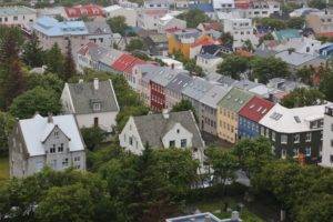
Although our hosts have loaned us their Toyota Rav IV, we decided to walk the 5km or so into downtown Reykjavik, starting the day at Hallgrimskirkja . This church is visible from almost everywhere in the city and one of Reykjavik’s most iconic buildings. Entry to the tower is 1,000 isk each to go up 8 floors in an elevator then one short flight of stairs. The view across the city in every direction is fantastic and well worth the price.
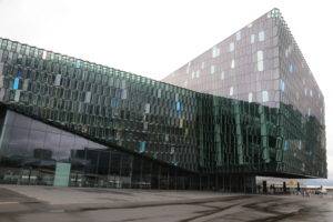 After waiting out some rain while we enjoyed the views, we continued our walk towards the waterfront to see the new concert hall. Harpa is Iceland’s 7 year old concert hall and is the largest in the country. The glass, honeycomb construction is impressive and offers some incredible photo opportunities.
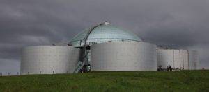 We walked back to Harpa concert hall to catch the free shuttle bus to Perlan , a rather unusual building on a hillside within a park, the Oskjuhlid recreational area, in Reykjavik. It is a dome built on top of four water reserve tanks for the city and is, apparently, a spectacular viewing spot for northern lights as well as panoramic views of the city.
The next day we left Reykjavik in our Toyota Rav IV after filling up with Diesel at the nearby N1 gas station. Navigating the numerous roundabouts to leave the city wasn’t too difficult and we were soon on the open highway on a cool, windy and drizzly day.
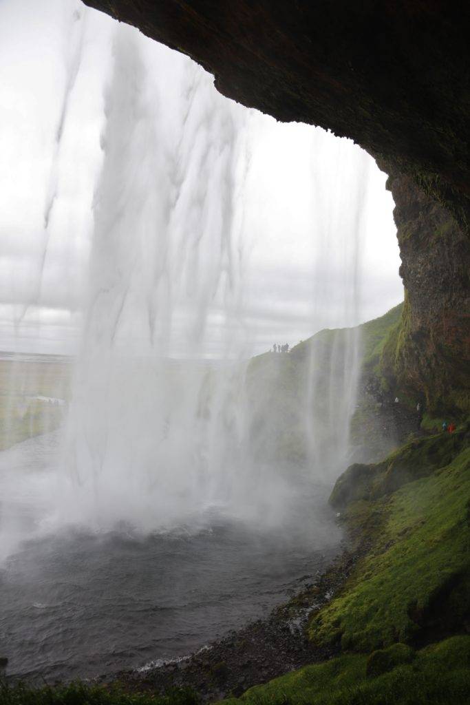
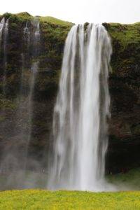 We chose to circle the country heading east first, along the south side of the island with the coast more or less on our right. In this direction, we found ourselves spotting waterfalls regularly, crashing down off of the hills and cliffs that were constantly along our left side. Our first stop after 90 minutes or so was Seljandfoss waterfall. Clearly visible from the highway, this group of 3 waterfalls was quite impressive.
The main waterfall is very high and spectacular! There is a path and steps to walk right around it but good waterproof rain gear is absolutely necessary as well as very good footwear as it can be quite slippery! Falling to your death can really ruin an otherwise great vacation, for you and the other tourists nearby.
Luckily I was prepared for this wet experience with a heavy rain poncho, waterproof cap, pants and shoes and I even managed to get a few photos from behind the falls without soaking my Canon 5Ds camera and the rest of my equipment too badly. From the front, I used my Velbon AEF-3 tripod for most shots and my Canon EF 24-105/f4 L zoom but I also had my Canon EF 70-300/f 4-5.6 L IS USM, Sigma DG 12-24/f 4-5.6 II HSM and Sigma DG 150-500/f 5-6.3 APO HSM lenses along for other scenery and wildlife. If you have room in your luggage and want some really good shots, definitely bring your tripod.
A short hike away from the crowds brings you to two other waterfalls with a lot fewer people around. The furthest falls are half hidden through a narrow passageway, parting the cliff face in a tall vertical crack.
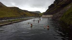 The Seljavallalaug swimming pool location is unsigned and well off the highway on a little dirt road through some farm land. The turn is 3.3 km west of the Heimemenn Mini Market on Rauferfell 242 road then follow the sign to Seljavalla which eventually stops at a small rough parking area. The trail was rough, rocky ground with some small streams to cross, hills and boulders to climb, but
 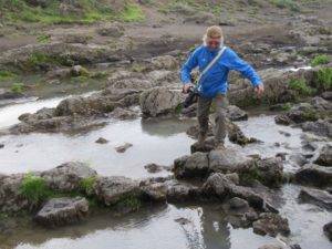 we eventually found the pool. It‘s a very rough, unattended natural hot springs, flowing constantly into and out of a large and very old cement basin. There is an old building with three rooms used as change rooms. Rough, dirty, and with some equally dirty wooden slats on the floor, all quite rustic and left to nature. The water is very warm, about half the 60 foot length is only 4 feet deep, then VERY deep towards the far end where the hot water enters. There is a lot of mossy particles and debris in the water, so it’s not for everyone, but we thoroughly enjoyed it.
We drove on, through rainy, windy roads alongside green, brown or black devastated lava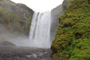 fields and then alongside huge, lush, green and rocky cliffs with various sizes of waterfalls constantly being spotted. Our next stop was at Skogafoss falls which are very impressive with the greatest volume of water of all the Iceland falls (possibly, depending on which publication you read). We started out climbing the 527 steps winding up the steep mountainside to see the falls from the top. It was interesting, and worth the climb, but not nearly as photo worthy as the view from the bottom. The typical front view of the falls makes for beautiful photos but you can also walk in along the side of the falls around a huge open basin area. Unfortunately the volume of water spray soaking me and my camera equipment made it nearly impossible to get any shots worth keeping.
Dyrholaey is a small peninsula along the south coast, near the village of Vik. The shoreline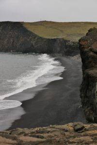 hillside is made up of interesting rock formations, a black sand beach and Puffins nesting on the cliffs.
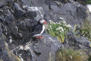 The day had been getting progressively colder, windier and drizzly so Puffin photos were challenging; particularly so because the Puffins were mostly hiding in crevices in the cliffs but I did manage to get a few shots with my 500mm lens and using the tripod.
Driving on from here we were in the middle of lava fields on both sides of the road for the next 62 km! The feeling of being on another planet was never stronger, with bumpy fields of black, or green or brown moss, surrounding us to the horizon.
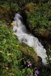 We started the next day with some take out coffee from the hotel restaurant and a hike up behind Klausterhof Guest House to view the beautiful waterfall coming down the mountainside behind it.
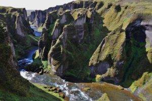 Then a short 11 km drive brought us to Fjaoargljufur Canyon. It’s a moderately easy hike up the canyon to see some dramatic views and unusual land formations.
Leaving the canyon we had to drive back past our guest house and another 48km to Vatnajukull National Park to view glaciers and iceberg lakes. We passed by the remains of an old bridge from when a volcano erupted and melted a large portion of Hvannadalshnukur glacier and the flash flood from that washed out the road and bridge. Apparently this has happened three times over the past few centuries.
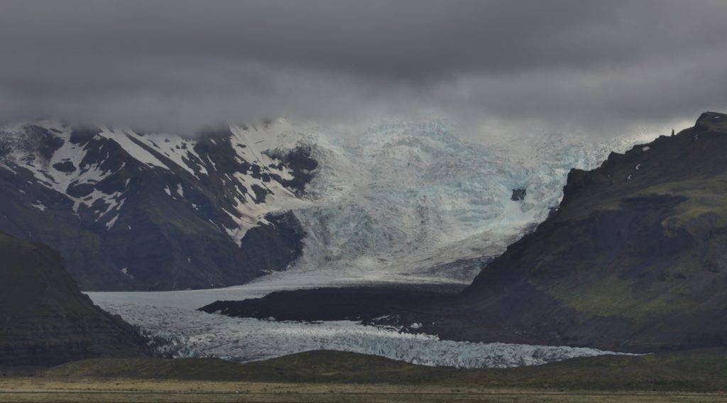
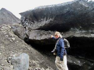 We stopped at the huge parking lot and visitor centre almost at the foot of Skaftafell Glacier. Although there were guided glacier walking tours available, we chose to head out on our own. A short hike brought us to the small lake at the foot of the glacier with several small icebergs floating around. The glacier was very black at this end, covered in volcanic debris and dirt, but lots of white snow and ice was also visible with hints of blue here and there. We decided to hike around the lake right up to the glacier. Specialized equipment and safety gear is needed to climb on the ice but we went ahead and climbed on the edge with no gear at all but it was very slippery, cracking apart with pieces falling so we stayed only a few minutes and hiked back to the visitor centre for some refreshing Viking beer.
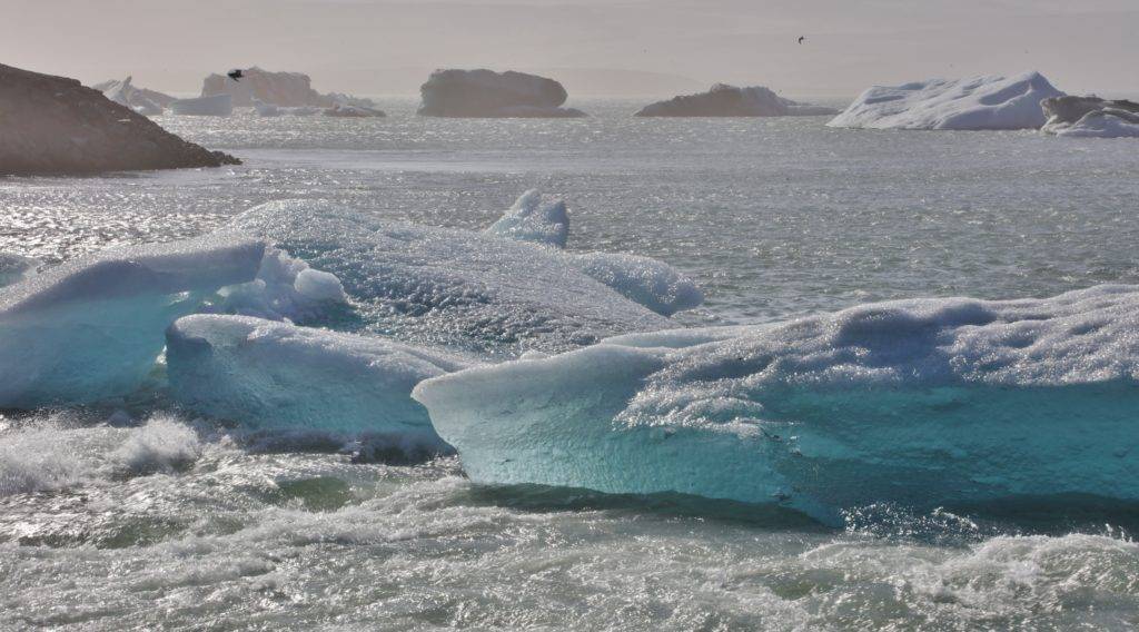
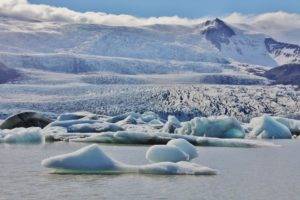 We drove on about 47 km to Fjallsarlon glacial lagoon. The lagoon is the small lake at the base of the glacier from melting ice and is filled with various sizes of icebergs, breaking off of the glacier. Its really an incredible sight with white, black, clear and blue ice in all shapes and sizes.
A few minutes more driving we came to our last stop for the day, Jokulsarlon iceberg lake. This one is huge with hundreds of icebergs and the lagoon drains into Iceland‘s shortest river of maybe only 1/2 km long and the icebergs flow down it into the ocean. We didn’t stay too long as the weather had turned very cold with incredibly strong winds.
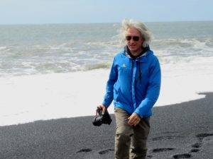 After a good night sleep at the Hotel Jokull we enjoyed a good selection for our free breakfast before hitting the road again towards Egilsstaðir. We continued to follow Hwy 1 along the tops of the cliffs by the ocean. We dropped down to the beach after a while and walked around on the volcanic black rocks, pebbles and sand.
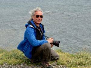 We continued down the road, stopping now and then at the numerous viewpoints. The terrain surrounding us varied from lava fields to high mountains, usually with unusual rock formations, on our left while the ocean side were mostly various shapes and sizes of black cliffs. Occasional wild flowers grew here and there in any little patch of dirt, even on the cliff-side rocks and throughout the lava fields.
Our first planned stop was 118 km from Hofn, the Fossardalur Blue Waterfall. There is a 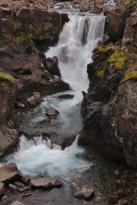 rest stop on your left just a few yards before the F939 gravel road which cuts back then up a hill and then a sharp hairpin turn up to the right. The parking area is on the right side of this road immediately after the hairpin turn. It’s a very short walk from here to the falls which are very pretty and definitely have hints of blue.
We continued on, stopping at some viewpoints along the way until we entered our first tunnel of which Iceland has several cutting right through the mountains! It was dimly lit, speed limit of 50km, very narrow, two-way, and nearly 6 km long.
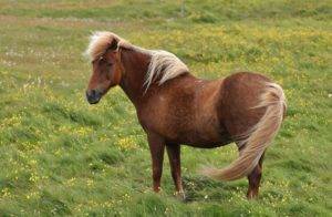 As soon as we exited the tunnel we saw two beautiful Iceland horses by the road on some fenced farm property so we pulled over to take a few photos. They were very friendly and in fact, it was nearly impossible to get a photo as they kept following us really close to get some pats.
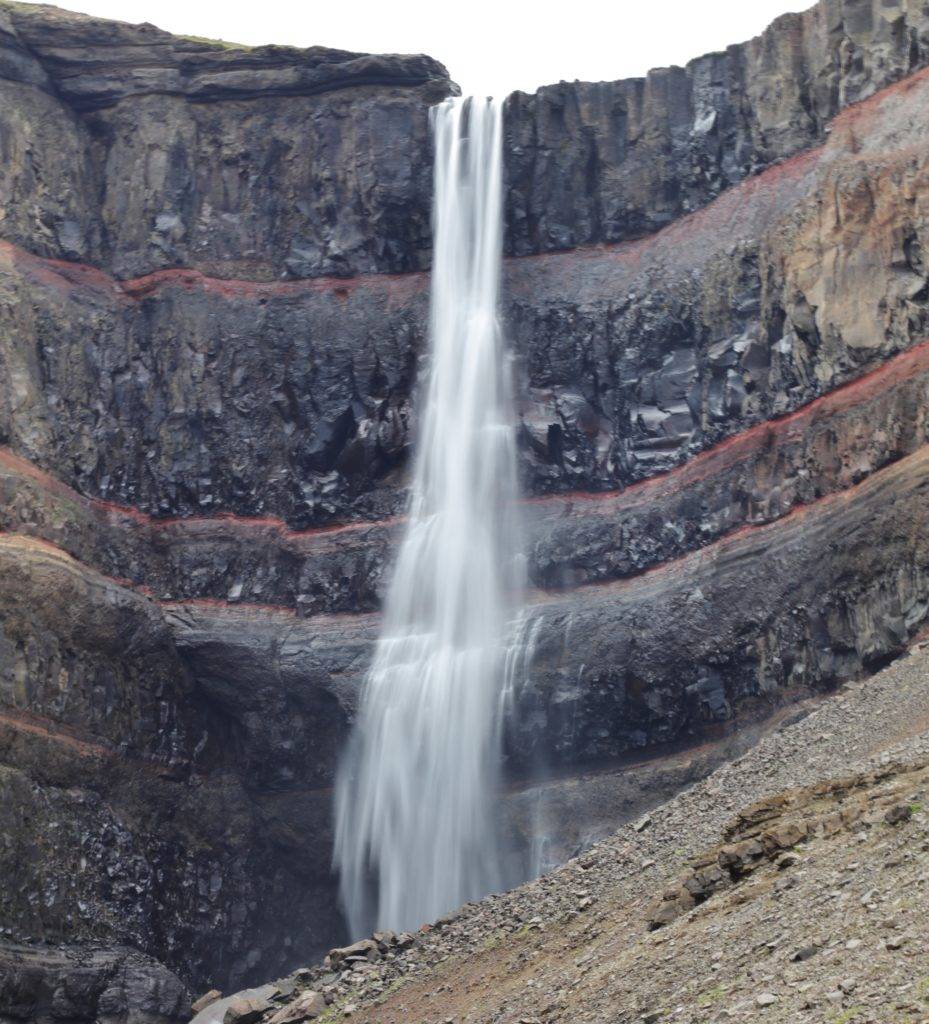
We were driving ocean-side again into a fjord and stopped in a small town soon after to fill up with diesel at our usual N1 gas station then continued on to Hengifoss waterfall which is the 3rd highest waterfall in Iceland at 128 meters. The parking lot is right by the junction of highways 931 and 933, on the north side of the Lagafljót River. There is a small falls near the bottom then the hike to Hengifoss is about 2.5 km mostly uphill, quite steep at times. About halfway up you come to Litlanesfoss waterfall surrounded by hexagonal columns, frequently formed when lava cools.
Near the top the path becomes less defined and rougher with a lot of rocks and boulders but eventually you reach the top. It took us about 45 minutes of steady climbing to reach Hengifoss but it was really quite spectacular, surrounded by horizontal and vertical colourful rock formations. The downhill hike was much faster and easier, taking only 30 minutes.
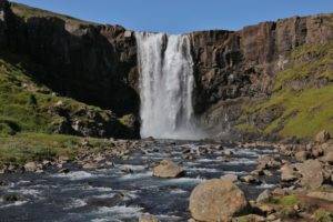 The next morning was clear and sunny, a nice change from the cloudy, drizzly weather of the past few days. After breakfast in our accommodation at Skipalaeker Cottages on the north side of the river in Egilsstaðirwe, we packed up, checked out and headed across the bridge into the main city then onto Hwy 93 up the mountains above the snow level with a short stop near the top at Gufufoss falls. Its a beautiful waterfall with good
 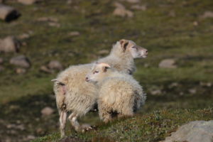 parking right beside the road. I got a few waterfall photos then some sheep photos and then back in the car for a very steep descent down to the town of Seyðisfjörður , at the inner most point of the fjord of the same name. Its a cute, artsy little town and is also where you catch the ferry to Denmark.
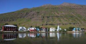 We walked around the town and explored a few arts and handicraft shops before heading back up the mountain and down into Egilsstaðir again then inland NW on HWY 1.
Our drive took us through Vatnajökull National Park and a wide variety of unusually shaped mountains, rock formations and huge lava fields. We stopped at one particularly busy rest stop in the middle of a lava field where everybody was taking turns having their photos taken sitting in a chair on a small hillside in the middle of the lava field.
Out in the middle of nowhere, we came to our turnoff for Dettifoss and Selfoss waterfalls.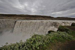 There is a huge parking lot and well marked, and easy trails to each waterfall. They were both spectacular in their own way and well worth the stop. Detifoss is said to be the most powerful waterfall in Europe spilling over 500 cubic metres of water per second. Its water comes from the nearby Vatnajökull glacier and the water is greyish from sediment. Selfoss waterfall is only 1 1/2 km walk away and is on the same river Jökulsá á Fjöllum.
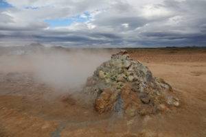 We drove on from here to the volcanic mud pots and steam vents at Námaskarð , or Hverarondor Hverir. It’s located just off of Hwy 1 just as you go by Lake Myvatn. As we approached the area we could see steam rising from dozens of locations across the alien, colourful landscape and a horribly strong sulfurous odour. There are carefully marked walking areas that keep you at supposedly safe distances although you are surrounded by 200c boiling water, bubbling mud, deep craters and huge steam vents. It feels as though one wrong step would lead to certain death or at least the loss of a foot!
From here we drove to the Myvatn Nature Baths , just 105 km south of the Arctic Circle. 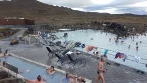 Our entry cost us 4,700 isk although the prices vary throughout the year so check the website for current prices. The baths are behind a large building housing a restaurant, change rooms and showers.
The pool lagoon is naturally heated thermodynamically and is quite large with a slightly smaller pool at a lower temperature. There is also an even smaller pool at a hotter temperature that was packed all the time as it was a very cool day. They also advertise a steam bath which we never did find. This was a great way to relax our muscles and warm up near the end of our long day.
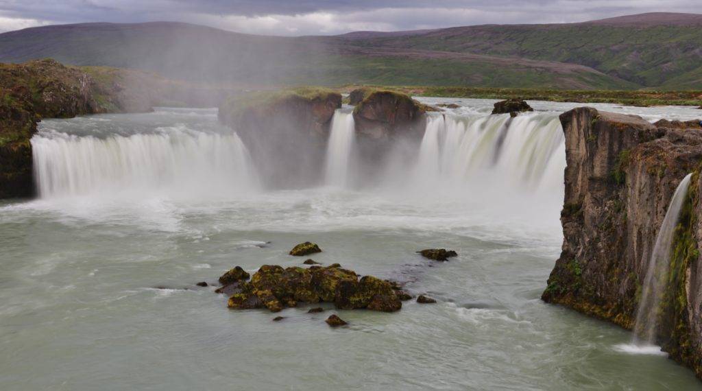
We left the baths feeling refreshed and ready to do a bit more exploring so we continued on our way to Godafoss. Godafoss waterfall is one of the most spectacular waterfalls in Iceland, in the NW region not far from Akureyri on the river Skjálfandafljót. There are two parking areas, each about a 10 minute walk from the falls, one on each side of the river and we chose the second one over the river. It was getting dark with heavy cloud cover but with my tripod I was still able to get some good shots.
Our last drive of the day after viewing Godafoss was to the city of Akureyri . Although it is only a small city with about 17,000 residents, it is the second largest city in Iceland, located at the head of Eyjafjörður fjord just below the Arctic Circle.
Before leaving Akureyri the next morning, we walked around the town a bit, climbing up about 150 steps to Akureyarkirkja, or The Church of Akureyri. Built in 1040, it towers over the city up on a high hill.
We left Akureyri, driving up Eyjafjörður fjord, the longest fjord in Iceland. The views are spectacular and it was only a short drive to reach The Beer Spa just before Dalvik. The Beer Spa has a nice lounge with light snacks, warm atmosphere with beautiful views. Opened just over a year ago, the Beer Spa is both a Craft Brewery and also a unique spa where you can soak in tubs full of beer, water, hops and yeast.
Leaving Dalvik and driving up and around the tip of the Tröllaskagi Peninsula on hwy 76, 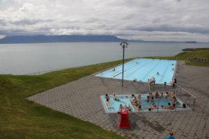 the road was good although narrow, along cliff edges with no shoulder or guard rails. Our next stop was in the town of Hofsos, 94 km from Dalvik, at their geothermally heated swimming pool. The outdoor Hofsos pool is on a hillside at the ocean’s edge with basalt column steps bunched up below, very reminiscent of Giant’s Head in Northern Ireland. As it was cool out, the giant hot tub was packed with people, leaving the main pool quite open for swimming.
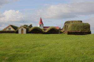 Another 52 km along hwy 76, following the ocean shoreline around the bottom of Skagafjörður fjord, then across the bottom of the peninsula, brought us to the Glaumbaer Turf Houses . There is also a small info centre and museum there and the site is well worth a stop.
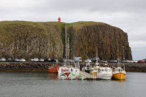 From here we still had nearly 270 km to drive to reach Stykkishólmur where we had a guest house booked for the night. The views along our route beside the Hvammsfjörður fjord with the setting sun just above the horizon in the distance were quite spectacular!
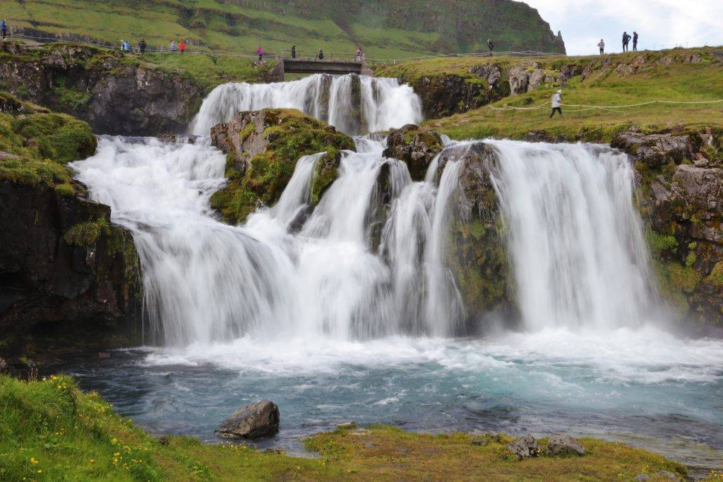
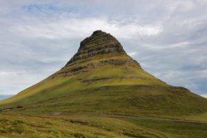 The day began with a mix of sun and cloud, gradually threatening rain. Our first planned site was just 45 km away at Mount Kirkjufell and Kirkjufelsfoss waterfall. The mountain is visible for several kilometres as you approach. This beautiful and unusual mountain really stands out and is by far the most photographed mountain in the region.
There are numerous short and long hiking trails up and around the mountains in the area of the waterfall and we could see people here and there on the trails. We climbed the short and easy trail up to the falls and even though there were a lot of tourists around, I was able to get some good photos. I also took advantage of the great location to get several shots of the mountain. It’s cone shape and brilliant green colour is quite captivating so I ended up with a lot of photos from various angles. The lighting was great too with mottled sunshine moving over the hillside as the day gradually clouded over.
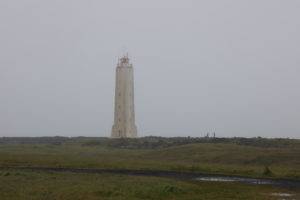 The weather continued to get worse as we traveled down the road, with steady rain and heavy fog gradually making visibility very poor. We stopped at the Malariff Lighthouse and Visitor Centre with a very good small museum with lots of photos and information about the area. There is a great lighthouse, the tallest we had seen so far, that was partially obscured by the fog and steady rain.
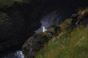 Just a few km’s further along we turned off at Hellnar . Drive past the restaurant and stop at the parking area to walk around and see a great shoreline with lots of birds and interesting rock formations.
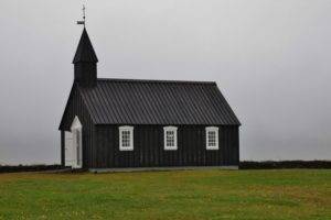 Our last scheduled stop before arriving back in Reykjavik was Búðir , to see Búðakirkja, the famous little black church. Originally black from being covered in pitch for protection from the elements, it is not actually unique as there are three black churches around Iceland, although this one is by far the most photographed.
Most people visiting Iceland for only 1 to 3 days find that the most effective use of their time, to get a reasonably varied view of the different facets of this country, arrange to drive or take a day tour around the Golden Circle. Although we had just returned from 6 days exploring the entire circumference of Iceland, we wanted even more, so we set off in our car to see some highlights of the Golden Circle.
Leaving Reykjavik travelling south on Hwy 1, you pass across an area with giant hot water pipes laying on the ground across the landscape. The Nesjavellir geothermal power station is visible, connected to the end of the pipes, and sends hundreds of gallons of hot water per second down the pipes to Reykjavik.
Highway 1 drops down into a valley and you turn left at the junction onto highway 360 which follows tightly along the edge of Þingvallavatn lake for a while before you turn right at the junction for highway 36. In just a few minutes more you reach Þingvellir (THING-VETT-leer), National Park., a UNESCO World Heritage Site.
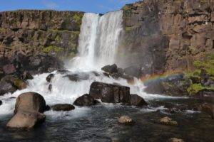 Waterfall is an easy uphill walk from P2 where we parked and very photo worthy and the sunny day even rewarded us with a partial rainbow in our photos. Below it, along a path downstream a few hundred metres and just below a small waterfall is Drekkingarhylur, the “Drowning Pool”, where women suspected of witchcraft were drowned between the late-16th and mid-18th centuries.
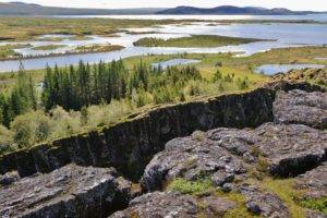 From here you can continue walking on a good, wide gravel path towards the viewpoint overlooking the very visible fissure dividing the two continental plates. You can clearly see a very large fissure running off both left and right and a variety of smaller ones. The tectonic plates are shifting apart here about 3mm a year.
Walk back down the path then turn right across a small bridge over the Öxará river flowing into Þingvallavatn Lake. This is Iceland’s largest lake, fed by Langajökull glacier. This path takes you to Þingvellir Church and next to it, Þingvellir House which is the official summer house of the Prime Minister of Iceland.
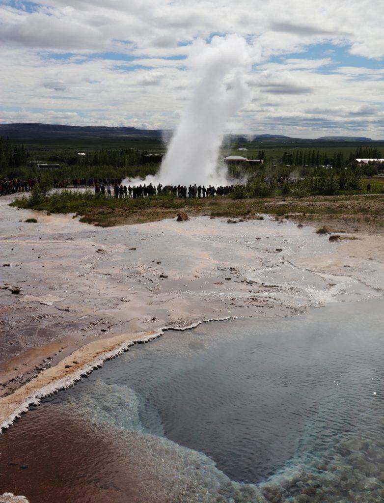
Leaving the park, we continued east on highway 36 for nearly an hour to reach the Geysir Geothermal Field . Strokkur is the name of the main attraction here; this geysir will suddenly erupt an explosive stream of boiling water up to 50 feet high. It erupts every 5 to 15 minutes or so with varying height and although everybody loves being right beside it when it goes, including me, photos are actually much better from a little further away.
Geysir (GAY-sear), is actually an Icelandic word which literally means “the gusher.” The famous original geysir is here and clearly marked, although it very rarely erupts any more and Strokkur is now the star of the show.
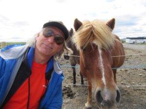
Just a couple minutes further along hwy 35 there is a parking area on your left with a small hot dog and coffee stand. The attraction here is the very calm, older Icelandic horses penned beside it. You can buy some special Horse Candy to feed the horses and take your photos while patting them.
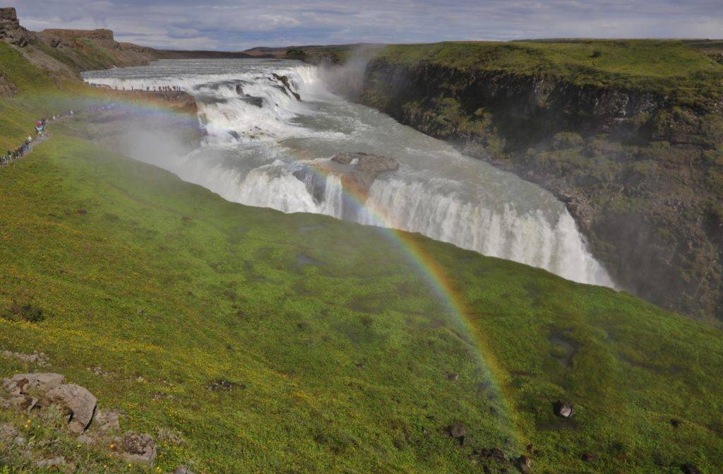
Continue in the same direction for another 10 minutes to reach Gullfoss waterfall. Gullfoss (GUTL-foss, “Golden Falls”) is situated on the wide, glacial Hvítá river. The rocky upper falls have a drop of about 35 feet, and the lower falls drops about 70 feet straight down into a narrow gorge which unusually, runs not straight out but off to the side of the falls.
The spray up out of the gorge can really soak you and a strong, cold wind is often blowing here so dress warm and waterproof. We were lucky enough to have the sun out, creating a dramatic rainbow across the falls, one of the best ever, a regular local assured us.
Leaving, it is necessary to backtrack the way you came on highway 35 and pass by Geysir again. Shortly after Geysir, make a left turn to stay on highway 35 toward Reykholt and Selfoss. From this corner it is 41 km along hwy 35 to reach our next stop, the Kerið crater.
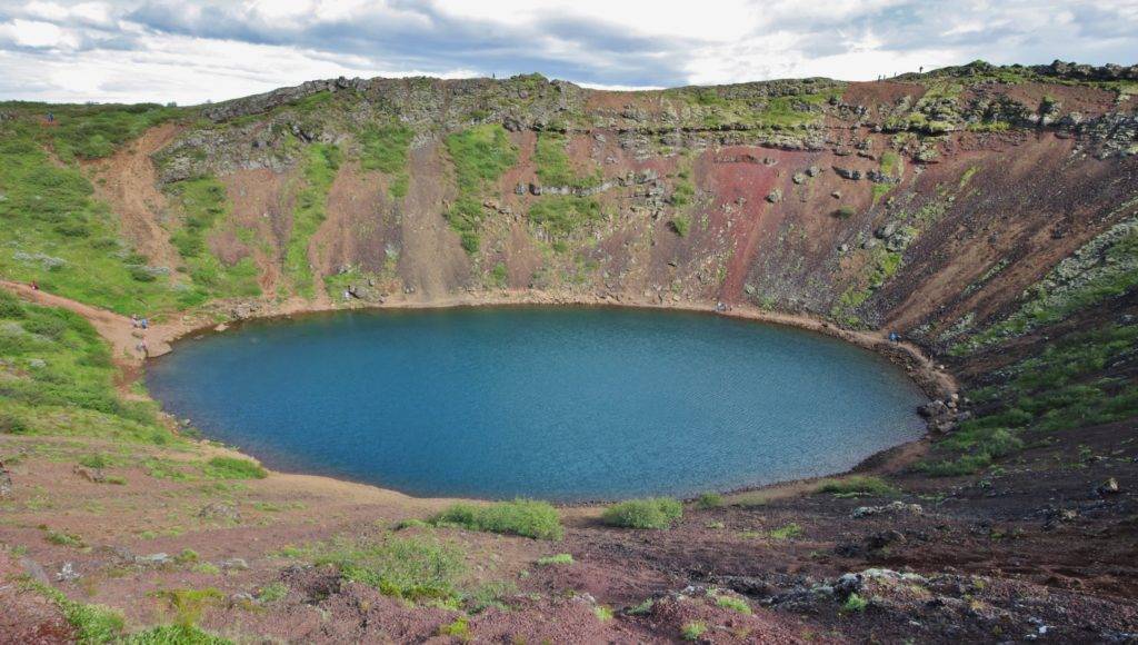
Kerið Crater (“ The Tub”) was formed about 6500 years ago, probably by a small magma chamber in the crater which emptied at the end of an eruption, leaving a collapsed top to form the crater.
There is an entry fee here of 400 isk which gives you access to a path around the rim of the crater as well as a stairway taking you about 55 metres down inside to the edge of the small lake filling the bottom which is another 7 – 14 metres deep. There is also a rough path all around the water’s edge, although the best photos are from the top edge of the crater.
Leaving here we continued along hwy 35 reaching hwy 1 in just a few minutes. To our left on hwy 1 is the beautiful Selfoss falls, usually included on a Golden Circle tour. But as we visited them just a week ago at the start of our Ring Road adventure, we turned right instead, back towards our home in Reykjavik.

